


Einführung/Introduction Zimbabwe/Simbabwe
Simbabwe umfasst 390.757 km² im südlichen Afrika. Das Binnenland zwischen dem Limpopo und dem Sambesifluss. Neben einem ausgeweiteten Hochplateau im Landesinneren gibt es Gebirgszüge im Osten und Tiefland im Norden, Süden und Westen. Die Regenfälle werden variabler, einerseits sorgen Starkregen und andererseits vermehrte Dürren für Schwierigkeiten. Auch die Wirtschaftsprobleme steigen.
Weitere Informationen zu Simbabwe
Zimbabwe occupies 390,757 km² of land in south central Africa, between the Limpopo and Zambezi rivers. The land-locked country is bounded by Mozambique to the east, Zambia to the north and north west, South Africa to the south, and to the south west by Botswana. It lies wholly within the tropics and is part of the great plateau which traverses Africa.
Source: https://www.sadc.int/member-states/zimbabwe
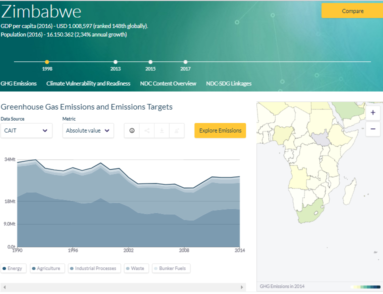
Climate Watch Data / Klimadaten: Zimbabwe
Source: SDG Linkages Northrop, E., H. Biru, S. Lima, M. Bouye, and R. Song. 2016. “Examining the Alignment Between the Intended Nationally Determined Contributions and Sustainable Development Goals.” Working Paper. Washington, DC: World Resources Institute. Available online at: www.climatewatchdata.org